OFF
Advanced Utility Line Locating – US Edition
- Lifetime Access
- All Levels
- PDF Certificate
Learn With Confidence




Overview
Advanced Utility Line Locating – US Edition
Underground utilities are an essential part of modern infrastructure. Electricity, gas, telecommunications, water, and other services are often installed below the surface, making accurate utility locating an important part of construction, excavation, maintenance, surveying, and infrastructure projects. Before ground is disturbed, understanding what may be beneath the surface can help organisations reduce avoidable risks, improve project planning, and support safer working practices.
The Advanced Utility Line Locating – US Edition course is designed to provide learners with a practical introduction to advanced techniques used when identifying, locating, mapping, marking, and interpreting underground utilities. The course explores electromagnetic locating principles, advanced locating techniques, Ground Penetrating Radar (GPR), GPS and GIS applications, utility marking, and advanced data interpretation.
Designed with the US context in mind, this course provides a structured learning experience for individuals who want to develop their knowledge of advanced utility locating methods and technologies. It can be particularly valuable for professionals working around excavation, construction, surveying, engineering, utilities, infrastructure, and underground asset management.
Why Advanced Utility Line Locating Matters
Underground utility networks can be complex. Utilities may vary in depth, material, configuration, age, and condition. Records may also be incomplete, outdated, or inconsistent with actual site conditions.
This makes utility locating an important process when planning work that involves excavation or ground disturbance.
The Advanced Utility Line Locating – US Edition course introduces learners to methods and technologies that can support the identification and interpretation of underground utility information. Rather than relying on a single locating technique, learners explore multiple approaches and consider how different technologies can complement one another.
Accurate locating can support better project decisions, improve communication between field teams, and help reduce the likelihood of unexpected encounters with underground infrastructure.
The course does not replace required qualifications, site-specific procedures, utility owner requirements, or applicable US laws and regulations. Instead, it provides foundational and advanced knowledge that can support further professional development.
What You Will Learn
By completing the Advanced Utility Line Locating – US Edition course, learners will develop an understanding of:
-
The fundamentals of advanced utility line locating
-
How electromagnetic locating works
-
Active and passive locating concepts
-
Advanced electromagnetic locating techniques
-
The role of Ground Penetrating Radar in utility locating
-
How GPS and GIS can support utility mapping
-
Principles of utility marking and surface mark-out
-
How locating information can be interpreted and analysed
-
Challenges that may affect locating accuracy
-
How multiple locating technologies can be used together
-
The importance of accurate documentation and data management
-
How to approach underground utility locating in a structured and methodical way
The overall goal is to help learners develop stronger technical awareness and a more systematic approach to utility locating activities.
Module 1: Introduction to Utility Advanced Line Locating (UALL)
The course begins with an introduction to Utility Advanced Line Locating and the role it plays in identifying underground infrastructure.
In this module, learners will explore the purpose of advanced utility locating and the types of underground services that may need to be identified during construction, excavation, maintenance, and infrastructure work.
Understanding the underground environment is essential because utilities can be difficult to identify from surface observations alone. Different materials and installation methods can influence how utilities are detected, and site conditions can affect the performance of locating equipment.
The introductory lesson establishes the foundation for the remainder of the course by explaining the overall locating process and the importance of using appropriate methods for the conditions encountered.
Learners will also develop an understanding of why professional utility locating requires careful observation, equipment knowledge, interpretation skills, documentation, and communication.
By completing this module, learners will have a clearer picture of the role of advanced locating within modern infrastructure projects.
Module 2: Basic Principles of Electromagnetic Locating
Electromagnetic locating is one of the key technologies used to identify conductive underground utilities.
This module introduces learners to the basic principles behind electromagnetic locating and explains how locating equipment can detect electromagnetic signals associated with conductive infrastructure.
Learners will explore fundamental concepts such as signal generation, signal detection, frequency selection, coupling, and the factors that can influence signal behaviour.
The course helps learners understand the difference between active and passive locating approaches and why selecting the appropriate locating method is important.
Learners will also consider how factors such as soil conditions, nearby utilities, depth, utility configuration, interference, and signal strength can influence locating results.
Understanding these principles allows learners to move beyond simply operating a locating device and begin interpreting what the equipment is indicating.
By the end of this module, learners will have a stronger conceptual foundation for using electromagnetic locating technologies appropriately.
Module 3: Advanced Electromagnetic Locating Techniques
Building on the principles introduced in Module 2, this module moves into more advanced electromagnetic locating techniques.
Underground environments can present complex challenges. Multiple utilities may be located close together, signals may interfere with one another, and some utilities may be difficult to trace using conventional approaches.
Learners will explore techniques for dealing with more challenging locating situations and develop a better understanding of how experienced locators approach complex underground environments.
The module focuses on improving the learner’s ability to interpret equipment responses rather than simply following a single signal.
Learners will consider factors that can affect signal quality and explore methods for improving confidence in locating results. The importance of checking findings, investigating anomalies, and avoiding assumptions is also emphasised.
This knowledge can help learners develop a more analytical approach when working in areas containing multiple underground utilities or challenging site conditions.
Module 4: Ground Penetrating Radar (GPR) Applications in UALL
Ground Penetrating Radar, commonly known as GPR, provides another technology for investigating subsurface conditions.
This module introduces learners to the applications of GPR within advanced utility line locating. Learners will explore how GPR can be used to identify subsurface features and how its capabilities differ from electromagnetic locating.
One of the important benefits of understanding GPR is recognising when it may complement other locating technologies. Different underground conditions and utility characteristics can produce different detection challenges.
Learners will examine fundamental GPR concepts, including how radar signals interact with subsurface materials and how reflected signals can provide information about potential underground features.
The module also introduces the importance of interpreting GPR results carefully. Not every subsurface response represents a utility, and professional interpretation requires consideration of the surrounding site conditions and other available evidence.
By completing this module, learners will understand how GPR can form part of a broader utility locating strategy.
Module 5: Using GPS and GIS for Utility Mapping
Modern utility locating increasingly involves digital mapping and geospatial technologies.
This module explores how GPS and Geographic Information Systems (GIS) can support the collection, management, visualisation, and documentation of utility information.
Learners will examine how location data can be captured and associated with underground assets. They will develop an understanding of how GPS can help establish geographic positions and how GIS can be used to organise and display utility information.
Accurate mapping can provide significant value beyond the immediate locating task. Properly documented information can support future maintenance, planning, construction, asset management, and infrastructure development.
The module also highlights the importance of data quality. Incorrect coordinates, incomplete records, inconsistent information, or poor documentation can reduce the usefulness of a utility map.
Learners will therefore develop an appreciation for the relationship between field locating, data collection, mapping, and long-term infrastructure information management.
Module 6: Utility Marking and Surface Mark-Out Techniques
Once underground utilities have been identified, communicating their location clearly at the surface is an important part of the locating process.
This module focuses on utility marking and surface mark-out techniques.
Learners will explore the purpose of surface markings and how they can communicate the approximate location and nature of underground utilities to other workers.
The course introduces the importance of clear, consistent, and appropriately positioned markings. Learners will also consider why markings should correspond with the information obtained through the locating process and applicable site procedures.
Effective mark-out can improve communication between locators, excavators, contractors, surveyors, engineers, and other project personnel.
The module also reinforces the importance of following applicable US requirements, utility owner standards, project specifications, and local procedures. Marking practices can vary depending on the type of project and jurisdiction, so learners should always verify the requirements applicable to their work.
By the end of this module, learners will understand how surface marking forms an important communication link between locating activities and field operations.
Module 7: Advanced Data Interpretation and Analysis
The final module brings together the knowledge developed throughout the course by focusing on data interpretation and analysis.
Advanced utility locating is not simply about collecting signals or measurements. Locators must be able to interpret information, recognise inconsistencies, compare evidence, and make informed decisions about what the data may indicate.
Learners will explore how information from electromagnetic locating, GPR, GPS, GIS, field observations, existing records, and surface markings can be considered together.
The module encourages learners to adopt an evidence-based approach. Where information conflicts or uncertainty exists, additional investigation may be necessary rather than relying on assumptions.
Learners will develop an appreciation for the importance of documenting findings clearly and maintaining accurate records that can be understood by other members of a project team.
This final stage helps learners bring together technical knowledge and analytical thinking to support a more comprehensive approach to underground utility locating.
Practical Outcomes of the Course
The Advanced Utility Line Locating – US Edition course is designed to provide practical, outcome-focused knowledge that learners can apply within appropriate professional environments.
After completing the course, learners should be better prepared to:
-
Explain the purpose and importance of advanced utility locating
-
Understand fundamental electromagnetic locating principles
-
Distinguish between key active and passive locating concepts
-
Apply knowledge of advanced electromagnetic locating techniques
-
Understand the potential applications and limitations of GPR
-
Appreciate how GPS can support utility location data collection
-
Understand the role of GIS in utility mapping and asset information
-
Apply principles of effective surface utility marking
-
Interpret and compare different types of locating information
-
Recognise factors that can influence locating results
-
Approach complex locating situations more systematically
-
Understand the importance of accurate field documentation
-
Communicate utility locating information more effectively
These outcomes can support professional development for individuals working in underground utility detection, construction, surveying, infrastructure, and related fields.
Who Should Take This Course?
The Advanced Utility Line Locating – US Edition course can be valuable for professionals and learners involved in underground infrastructure and ground-disturbance activities.
It may be particularly suitable for:
-
Utility locators
-
Construction professionals
-
Excavation personnel
-
Surveying professionals
-
Civil engineering teams
-
Infrastructure workers
-
Utility contractors
-
Site supervisors
-
GIS and mapping personnel
-
Asset management professionals
-
Telecommunications infrastructure workers
-
Electrical utility personnel
-
Individuals developing careers in underground utility locating
The course may also be useful for experienced professionals who want to broaden their understanding of modern locating technologies and digital mapping techniques.
Develop Advanced Utility Locating Knowledge
Underground infrastructure continues to become more complex, increasing the importance of reliable locating, mapping, and interpretation practices. Professionals working in this area need more than basic equipment familiarity. They also need to understand how different technologies work, how site conditions influence results, and how locating information should be interpreted and communicated.
The Advanced Utility Line Locating – US Edition course provides a structured learning pathway covering electromagnetic locating, advanced detection techniques, GPR, GPS, GIS, utility marking, and data analysis.
By combining these subjects, the course gives learners a broader understanding of how modern utility locating can be approached as a complete process rather than a single equipment-based activity.
Whether you are developing your skills for a career in utility locating, expanding your construction and infrastructure knowledge, or seeking a stronger understanding of underground utility detection technologies, this course provides a valuable foundation for further professional development.
Enrol in Advanced Utility Line Locating – US Edition today and develop the knowledge to understand modern utility locating technologies, interpret underground utility information, and approach utility mapping and marking with greater confidence and precision.
Course Modules
Course Content
Module 1_ Introduction to Utility Advanced Line Locating (UALL)
-
Lesson 1_ Introduction to Utility Advanced Line Locating (UALL)
Module 2_ Basic Principles of Electromagnetic Locating
Module 3_ Advanced Electromagnetic Locating Techniques
Module 4_ Ground Penetrating Radar (GPR) Applications in UALL
Module 5_ Using GPS and GIS for Utility Mapping
Module 6_ Utility Marking and Surface Mark-Out Techniques
Module 7_ Advanced Data Interpretation and Analysis
What our students say

Earn an Accredited Certificate
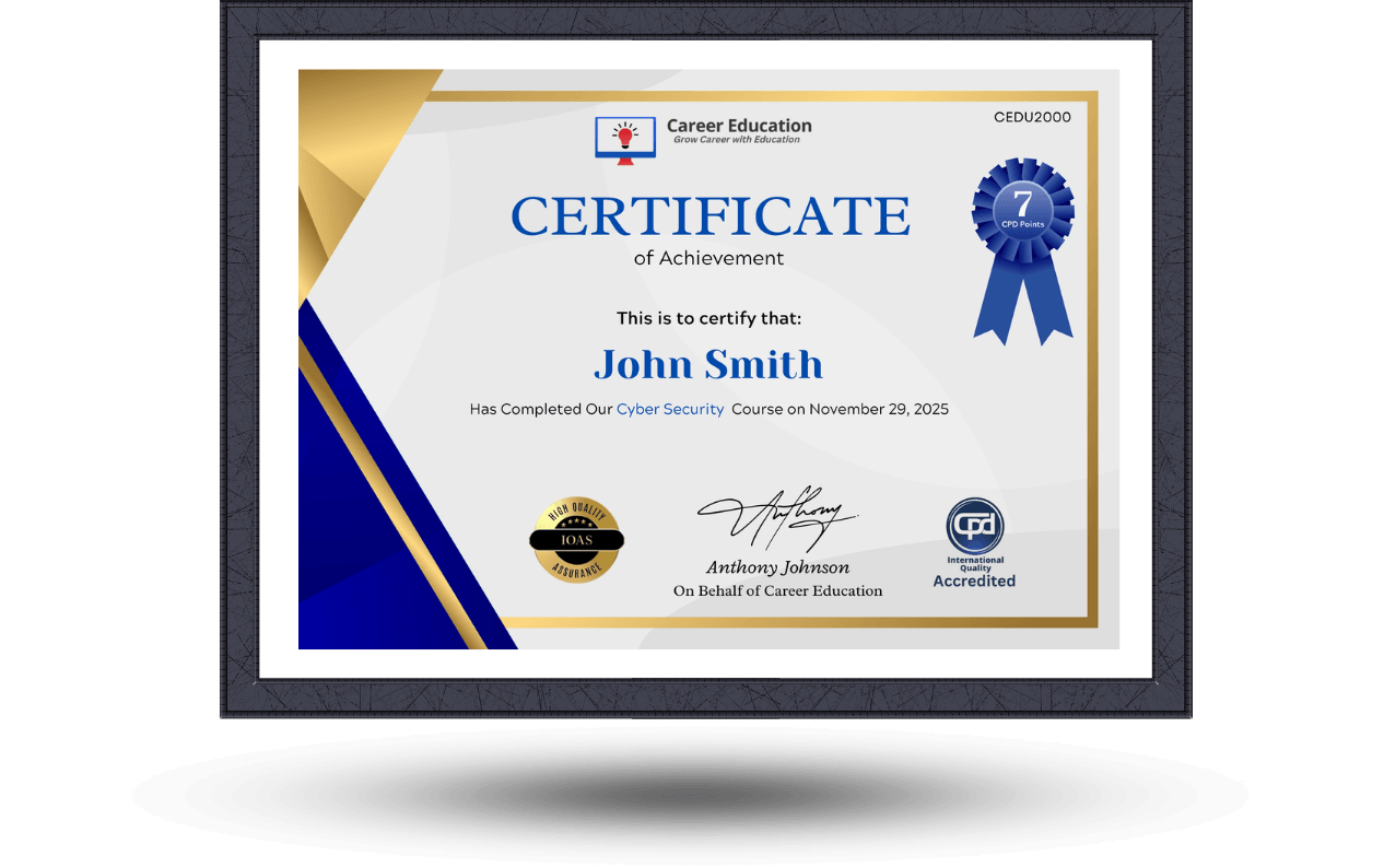
Upon completion of the course, an e-certificate will be downloadable from Khan Education signifying the completion of your course. But, the course is CPD Accredited and after you complete the assignment, you will be eligible to order a certificate accredited by CPD International Quality for £5.99 only. If you want a hardcopy certificate accredited by CPD IQ, you can get it for only £15.99.
Get your CertificateSimilar Courses